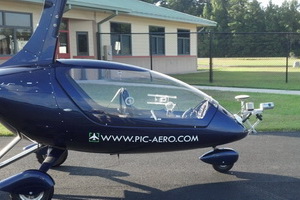
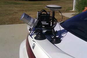
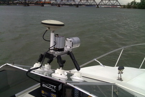
Size Matters
Very small size allows for easy transport and deployment on a variety of
survey vehicles. It can attach to any vehicle roof top, front or back of
vehicle, windshield etc., via suctions cups for secure mounting and
scratch-free contact. SNOOPY is easily attached to other surfaces using
commonly found tools such as pipe clamps. It can be easily levelled to
almost any vehicle surface.
Post-Processing Software
NovAtel's Inertial Explorer creates trajectories in tightly-coupled
processing mode using either base stations or deploying a Precise Point
Positioning (PPP) algorithm. In RTK mode no trajectory post-processing is
necessary. SNOOPY comes with Custom software to combine raw scan data with the
GPS/IMU trajectory into high fidelity point clouds. Additional Control
Point registration is included. The outputs are in the common point cloud
file formats such as LAS, LAZ and Text.
Control Software
No large storage or controller computer is necessary. Any laptop can be used
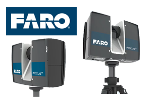
to control SNOOPY. Whenever possible the laser's native scanning software is
used directly to minimize learning curve and training (e.g. FARO Focus). A
very simple, robust system of control is provided via the laptop maximizing
already available vendor software.
Application Software
A wide variety of application software is supported by simply creating the
appropriate output formats and manageable file sizes. This includes
TerraSolid, Virtual Geomatics 4D, Orbit GT, TopoDOT, Carlson Software,
Autodesk, and many more.
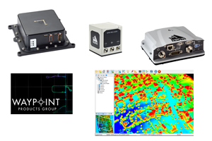
GPS/IMU Components
Configurable with the entire range of NovAtel SPAN GPS/IMU systems such
as IGM-ADIS, IGM-STIM, CPT as well as ISA-100C IMU's in either
RTK or Post-Processing with Inertial Explorer.